Teaching gis
Since fall semester 2021, I have had the inestimable privilege of serving as an adjunct assistant professor for the urban planning program at Columbia University Graduate School of Architecture, Planning & Preservation, my alma mater. I collaborate with an amazing instruction team in teaching Geographic Information Systems courses for planning, urban policy, and built environment analysis—emphasizing critical evaluation of sources and methods, purposeful visual communication, and spatial research design—using a variety of pedagogical approaches, including discussion-centered seminars and labs, project-based learning, and lectures.
geographic information systems (PLANA4577/8)
Geographic Information Systems (GIS) are tools for managing, describing, analyzing, and presenting information about relationships between what happens and where it happens. Through GIS, geographic features are tied to attribute data describing aspects of those features – some qualitative such as land use and some quantitative such as demographic information. For its analytical possibilities and because its techniques allow one to represent social and environmental data as a map, GIS has become an important tool across a variety of fields for studying urban and rural areas alike, including planning, architecture, engineering, public health, environmental science, epidemiology, and business. Further, GIS has become an important political instrument allowing communities and regions to (geo)graphically tell their stories. This course covers technical skills associated with and required in spatial analysis, conceptual issues in geographic thinking and research design, as well as practical examples and case studies of GIS as applied in urban contexts.
Sample Instructional Materials → Projections | Modifiable Areal Unit Problem | Density & Percent Change
Student Work Samples → Conflict Zones: NYC Open Restaurants | Green Roofs Site Selection | Scaffolding in Manhattan
Advanced Spatial Analysis (PLANA6232)
This course allows students to develop specialized approaches to spatial analysis while introducing a series of common advanced techniques and nuanced methodological questions. Aimed at covering a variety of topics with immediate relevance to urbanism in practice and in research, the course operates with a two-fold mission: (1) to critically discuss the theories, concepts, and research methods involved in spatial analysis, and (2) to learn the techniques necessary for engaging those theories and deploying those methods. The class will work to meet this mission with a dedicated focus on the urban environment and the spatial particularities and relationships that arise from the urban context. Among others, this course takes as a foundational premise that spatial analysis is an incredibly powerful and double-edged weapon: it provides both the methods for answering complex spatial questions and the means for effectively communicating the results. Like any other weapon it can serve many ends, and as such an advanced course in spatial analysis must frame its use within the developing discourse on professional practice and responsibility.
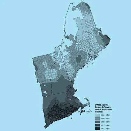
Sample Instruction Materials → Spatial Statistics, Geographically Weighted Regression, & Interpolation
Student Work Samples → Pandemic Subway Ridership | Urban Growth in Austin, TX

